ur-scape studio has moved
Visit our new website, with all-new video tutorials, an improved user experience, and the interactive Forum for networking with other ur-scape studio users.
❗ If you were a user of this version of ur-scape studio, your progress in existing courses is still here.
4500+
ur-scape Downloads
6
Pilot Cities
50+
Current Enrollments
2
Languages
Free
Price
Overview
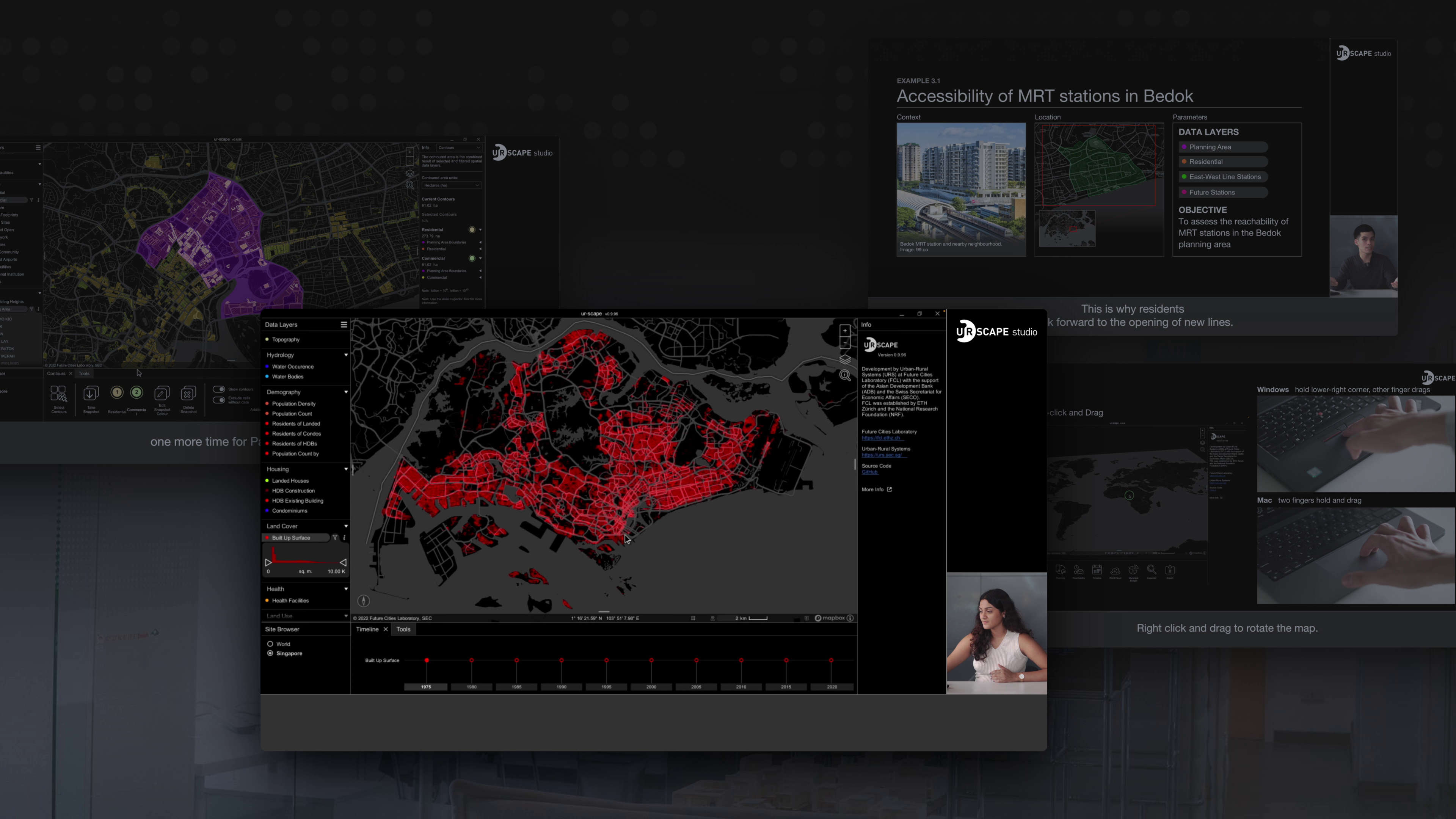
ur-scape studio is an online learning platform with video-based courses developed by Future Cities Laboratory Global. Through these courses, you will learn the fundamentals of geospatial data and how to use ur-scape for spatial analysis and visualisation. This course is designed to enable users of various backgrounds (e.g. urban planning, transportation, economics, sociology, etc.) to quickly and iteratively use spatial data to generate knowledge, find solutions, and facilitate engaging and interactive dialogues.
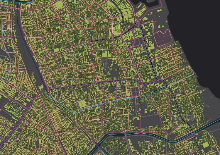
ur-scape is an open-source spatial planning tool designed to a) enable evidence-based planning across scales (region, city, town, and neighbourhood) and sites (global and local), and b) develop innovative forms of data collection, analysis, and visualisation needed for complex challenges (resilient urbanisation, climate change, equitable growth). In this context, we will cover the basics of Geographic Information System (GIS) and other commonly used remote sensing data types. We will provide step-by-step instructions on how to install and operate ur-scape. Through a series of exercises, you will also have the opportunity to explore the functionality of ur-scape and transfer a real-world planning issue into a spatial workflow.
Learning Objectives
At the end of this workshop you will be able to:
- Present a working knowledge of GIS
- Understand the fundamentals of spatial data types and data management
- Import various types of data into the ur-scape platform
- Perform basic analytics using the tools in ur-scape
- Visualize and develop maps in ur-scape to support strategic planning at various scales and sites.
- Integrate basic GIS knowledge and ur-scape tools with more specific planning objectives and challenges
Hardware Requirements
Windows
- Windows 7 or newer
- DirectX11 capable GPU
- 1 GB of hard drive space
- 2 GB RAM
MacOS
- MacOS High Sierra 10.13 or newer
- Metal capable Intel and AMD GPUs
- 1 GB of storage space
- 8 GB RAM
Curriculum
ur-scape studio has been structured into 3 courses with 11 lessons in total. The courses follow a linear sequence beginning with Setting Up, followed by GIS Knowledge and ur-scape. It is strongly recommended to follow the sequence for the best learning outcome.
The first course, Setting Up, provides a step-by-step guide to installing and set up QGIS and ur-scape.
The second course, GIS Knowledge, focuses on beginner users not familiar with GIS and introduces the foundational concepts of GIS including content management, data exploration, visualisation, spatial analysis, and spatial data science.
The third course, ur-scape, provides step-by-step video tutorials that introduce the functionalities of ur-scape for data import, data analysis, and visualisation using the various tools in ur-scape.
Each lesson has a video-based lecture, a step-by-step demonstration, problem-solving exercises to give a hands-on learning experience with real-world application, and quizzes that collect feedback from the participants.


ur-scape Studio Team
Prof. Stephen Cairns
FCL Global Director in Singapore
Stephen Cairns is Director of the Future Cities Lab (FCL) in Singapore, and Professor in Architecture at ETH Zurich. He also leads the Urban-Rural Systems design-research lab whose output includes the ‘expandable house’ sustainable pilot, exhibited at the International Architecture Biennale Rotterdam (2016) and awarded Best Living Space (Indo-Pacific) at the Inde Awards (2020). He co-edits the Future Cities Laboratory: Indicia series (with Devisari Tunas) (Lars Müller Press with NUS Press 2017, 2019 and 2021).
Dr. Yuhao Lu
Research Coordinator, FCL Global
Dr Yuhao LU’s research focuses on urban planning, spatial statistics, cartography, and data visualization. He is particularly interested in solving multi-scale and cross-disciplinary challenges using geospatial tools and time series (big) data.
In 2018, he graduated from the Integrated Remote Sensing Studio (IRSS) lab with a Ph.D. in detecting vegetation and socio-economic changes in cities using time series of satellite images. Besides research, teaching remote sensing and geographic information sciences has also been part of his work since graduate school.
Niraly Mangal
Research Associate, FCL Global
Niraly Mangal’s work involves projects in Indonesia with a focus on the development of smart systems and digital planning tool that aims to help decision makers make better informed, integrated, and inclusive planning decisions on the city and metropolitan level.
She has experience as Urban Data Specialist with expertise in geo-spatial data processing and management using GIS software.
Muhammad Salihin Bin
Zaol-Kelfi
ur-scape Software Engineer, FCL Global
Muhammad Salihin is a software engineer specializing in real-time interactive simulations and is a Research Assistant of the Agropolitan Territories of Monsoon Asia group at the Future Cities Laboratory.
Muhammad Salihin has keen interests in data visualization for various platforms including Virtual Reality (VR) and Augmented Reality (AR), cloud technologies and various artificial intelligence fields including machine learning and computer vision.
Local Facilitators
Dr. Aria Mariany
Senior Research Fellow
Aria Mariany is a Senior Research Fellow in Resilience Development Initiative (RDI). Her expertise is in disaster risk assessment, especially in community-based approach and regional and city planning. She is also a researcher at ITB Disaster Mitigation Research Centre and Centre for Earthquake Science and Technology ITB (CEST ITB). Currently, she is also active in a disaster-related community organization, namely Bandung Mitigation Hub (BMH), as President. She has published several academic writings regarding disaster risk management and climate change adaptation.
Husnul Aris Alberdi
Researcher & Program Manager
Husnul Aris Alberdi is a researcher and program manager in Resilience Development Initiative in Bandung, Indonesia. He has published several book chapters at the Indonesian Institute of Sciences (LIPI) and a working paper at RDI. He also likes to collaborate and build networks with other researchers. Although his background is in urban and regional planning, he is also interested in diverse research fields. His research interests include climate change, renewable energy, institutional capacity, and emission reduction. He also wants to learn more about energy policy, urban development, smart city, and public policy.
Aisha Hanifa Salsabilla
Research Officer
Aisha is well versed in plans and program making, with the ability on analytical and comprehensive thinking while maintaining good teamwork with colleagues. She has experience and is committed to exploring more projects related to the environment, renewable energy, and community development in the field of urban and regional planning.

Sakti Heriyansah
Research Officer
He is a political science graduate with multiple passions and interests, especially regarding science and scientific literacy, philosophy, and activism in socio-economics freedom. He is currently a research officer at RDI and also an initiator of an independent organization named Anthrophile network, which focuses on community development, science communication, and science fiction related to the hopeful future of human progress.